-40%
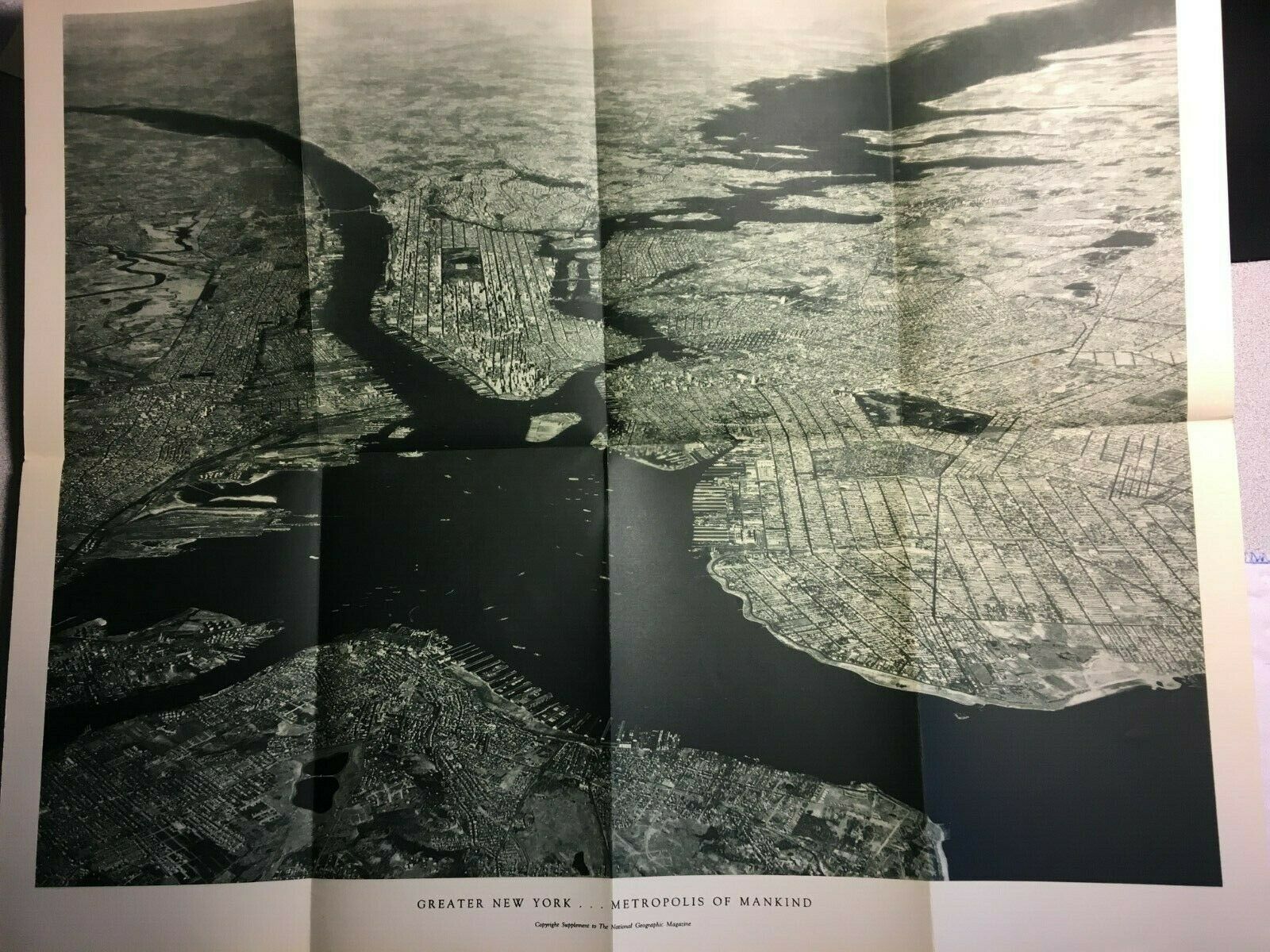
1933 NATIONAL GEOGRAPHIC MAP Arial View Map of Greater New York City
$ 2.63
- Description
- Size Guide
Description
1933 NATIONAL GEOGRAPHIC MAP Arial View Map of Greater New York City. Picture taken by Captain Albert W. Stevens from the U.S. Army Air Corps. at an altitude of 26,000 feet. Encompasses more than 3,000 square miles. Single birds-eye view of NYC in the 1930's. Issued as a supplement to the November 1933 issue of National Geographic Magazine.Hand written map description written on the back, along with a key of the major landmarks. Measures 23.5" X 19.4" (when unfolded).
I try to describe my items as accurately as possible, pointing out imperfections. However, please view the supplied pictures, with the zoom feature for details, in making your bidding decisions. Feel free to ask, if you have any questions or have a request for specific map picture/description.
I also allow Best Offers on all my listings. If you prefer to end the auction process early, you can instead provide me with "YOUR" Buy it Now Best Offer. I will consider all reasonable offers to end the auction. Thank you for looking!


